

Bus/tram stops
V. Bus/tram stops.
Stops are displayed on a map in two different ways (there are two separate and independent layers of information):
- On the determined route ( option- “I’m taking public transport”) these stops are displayed, through which the determined route leads. How it was already mentioned (Displaying routes on a map), there are presented using characteristic, round icons:
 .
. - The stops figure also as a separate category in the tab “More” in the right upper corner of a map:
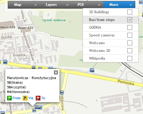
After choosing it (ticking) stops will be seen on a map as following icons: – bus stops,
 – tram stops.After clicking on stop icon you will see a window including timetable of all lines leaving from the particular stop.