

Routing
The following instructions describe step by step the process of routing for option “I’m driving a car” as well as “I’m walking”. Routing for option “I’m taking public transport” is described in a separate tab.
- Option 1 – adding route points using left panel:
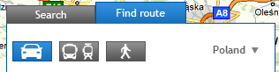
- In order to make routing space in left panel active please select tab “Find route”. It should be blue.
- In the empty spaces please type name of the locations, which should beginning and end of the desired route. The phrase should include town name, street name and house number – where town and street name (possibly with house number) are separated with a coma (see – example below). While typing the address of desired location, system will automatically suggest possible choices. When you finish typing, the route will be determined automatically.
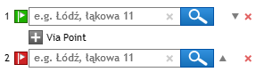
- Following the example, you can add the middle route point – into the space “Via point” please type the address . If you would like to add more than one middle point, repeat this several times.
- In order to make routing space in left panel active please select tab “Find route”. It should be blue.
- Option 2 – adding route points from map level:
- Another possibility of adding route points is using the context menu under right mouse button, which you will find after clicking in any map space:
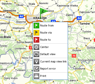
- In order to add route point, please click in a chosen place on a map using right mouse button and select – according to your needs – one of options: “Route from”, “Route via”, “Route to”. Then the chosen point will be set as an appropriate one in the routing panel (according to the choice – as the beginning, middle or end point). Repeat it as many times as all necessary route points will be set.After defining route points (either using routing panel or from map level), the route will be set automatically.
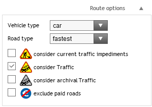
- You may also change route parameters (type of vehicle, type of road), consider current road impediments as well as current traffic along particular road section, so all information coming from Traffic system. You can also consider archival traffic data or exclude paid roads.
- Another possibility of adding route points is using the context menu under right mouse button, which you will find after clicking in any map space:
- After setting route you will see route from the beginning to the end point and a new tab with detailed route report appears, where i.a. each maneuver on the road as well as each route parameter (e.g. distance, journey time, cost) are described
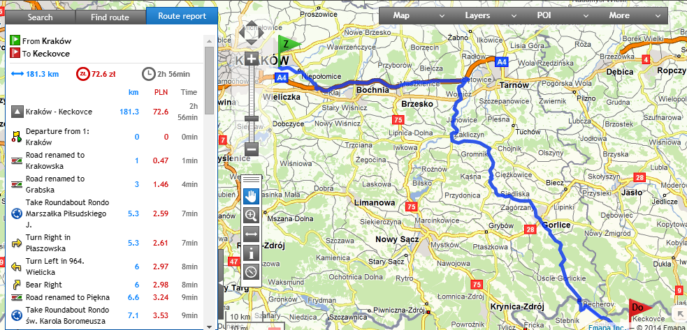
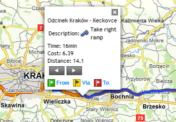
- Pointing with a mouse cursor onto particular maneuver in a tab “Route report” causes that it gets highlighted on a map with a detailed description.
As you can see using Emapi.pl is easy and there is no need for any additional IT skills or specialist knowledge and it offers a wide range of advanced possibilities.